
Volcano Mountain influential to the ground fertility is the main capital economic from a province. This area is agricultural land that is chockablock trees, such as; coconut palm, clove and nutmeg. Manado, North Sulawesi capital is really busy city. Unfolding to lowland, palm hill around the wide bay, encircled by fertile tropical plant. Do a journey to beach, South Manado to Tasik Ria beach and to Tanawanko, then leave the hinterland through Taratara to plateau town Tomohon. It is famous as "Interest Town", Tomohon between the two volcanoes, Lokon and Mahawu. Hilltop area have yield of fruits, vegetable, and the flower line, which is wide such as, trumpet flower, Bougainville, lily, gladiola flower, angelic and chrysene flower. The beautifully Inspirasi hill give town view with mount as the background. Two-hour climb from Kaskasan, will reside in beautiful top of the mountain. About 36 southwestern km is Manado city, the beauty of Tondano Lake have waited. Having vehicle through the pathway in Tondano through a real interesting rural and extent of clove garden. Around the lake there are a lot of restaurant providing delicious burning fish. All plateau, like this area is shown by many resident old cottages and interesting that you have to find. From the simple cottages until interesting cottages that built from odd hardwood, you will wish to spend some nights in cold climate.
source by NORTH SULAWESI PROVINCE Volcano Mountain influential to the ground fertility is the main capital economic from a province. This area is agricultural land that is chockablock trees, such as; coconut palm, clove and nutmeg. Manado, North Sulawesi capital is really busy city. Unfolding to lowland, palm hill around the wide bay, encircled by fertile tropical plant. Do a journey to beach, South Manado to Tasik Ria beach and to Tanawanko, then leave the hinterland through Taratara to plateau town Tomohon. It is famous as "Interest Town", Tomohon between the two volcanoes, Lokon and Mahawu. Hilltop area have yield of fruits, vegetable, and the flower line, which is wide such as, trumpet flower, Bougainville, lily, gladiola flower, angelic and chrysene flower. The beautifully Inspirasi hill give town view with mount as the background. Two-hour climb from Kaskasan, will reside in beautiful top of the mountain. About 36 southwestern km is Manado city, the beauty of Tondano Lake have waited. Having vehicle through the pathway in Tondano through a real interesting rural and extent of clove garden. Around the lake there are a lot of restaurant providing delicious burning fish. All plateau, like this area is shown by many resident old cottages and interesting that you have to find. From the simple cottages until interesting cottages that built from odd hardwood, you will wish to spend some nights in cold climate.
Rabu, 05 Desember 2007
NORTH SULAWESI PROVINCE
Selasa, 04 Desember 2007
DANA ISLAND
Dana is also called Nieuw Eiland and Hokki, the latter not known to the local people. Dana is a small, uninhabited island, situated thirty kilometers Southwest of Rai Jua. The rocky, south side of the island is exposed to deep ocean swells originating in the Southern Ocean, five thousands kilometers away. Sheep and goats are to be seen on the island. However, Savu and Rai Jua people do not go to Dana, except for the annual ritual ceremony. According to Savunese tradition, no one is allowed to visit Dana for any other purpose.Savunese believe that when they die, their spirit reside on Dana. They also believe that it is important to respect the space of others in order to maintain harmony in life. Since Dana is considered to be the space for the spirit of their love ones who passed away, it is considered disrespectful for westerners to visit the island. However, cruise ships and surf charters regularly visit Dana, without consultation with the Rai Jua elders, who are responsible for preserving the tradition.
source by
RAI JUA ISLAND
* Kolo Uju (Udju) is a village where ritual ceremonies are held. It is located in Lede Unu of Rai Jua District.
* Maja well is located in Lede Unu village of Rai Jua district. It is located about 5 km from the subdistrict capital. The well is an archeological remnant of Majapahit Kingdom.
* Rai Jua Beach is located I km from the main town. It is a white sandy beach for snorkeling and swimming.
source by www.indonesia-tourism.com
SAVU ISLAND
Savu is dry for large parts of the year, due to hot winds blowing from the Australian continent. Most rain falls during the months from November to March. Between 82% & 94% of all rainfalls during the west monsoon, with little or no rain falling for the months of August to October. The mean annual rainfall for Savu Island is 1019 mm. During the dry season, the islands' streams dry up, so the islanders depend on wells for their water supply. The land is covered for the most part by grassland and palms. Coral reef and sandy beaches fringe the three islands.
Namata
Namata is located in Western Savu. Namata is a traditional village where the ritual ceremonies are frequently held. There are megalithic stones and traditional houses. It is located in the Rai Lolo village, 3 km from the capital city of Heb'a (Seba) in western Savu district. There is a stone carving of a four mast tall ship. Though the writing beneath has faded, villagers say the Portuguese drew it in 1684.
source by www.indonesia-tourism.com/
ALOR AND LEMBATA ISLAND
Alor and Lembata Islands are the least visited and are therefore the most unspoiled regions of East Nusa Tenggara (NTT). Trek to the rim of Pantar volcano, visit the traditional whaling village on Lembata or dive the straits of Alor at a dive destination rated by all to be amongst the best in the world.
Alor Island regency is the least visited and therefore the most unspoiled region of Nusa Tenggara Timur (NTT). Trek to the rim of a volcano on Pantar or dive the straits of Alor and Pantar in a dive destination rated by all to be amongst the best in the world. Ponder on the existence of the Moko drums, which are not found in large numbers anywhere else in Indonesia and can be traced back to the Dongson period in Vietnam around 350 BC and you start to realize that Alor is truly a land lost in time.
Alor diving is known as the best in the world With its smoldering Volcanoes reaching down into crystal clear waters fringed with pristine coral reefs, coconut fringed pure white sandy beaches and traditional villages built half way up mountains, the scenery is as spectacular above as it is below the waterline. Alor Island is so mountainous that it is almost impossible to pass from one side to the other and many of the villages on the island itself can only transport themselves via small wooden ferries. The eight distinct dialects and more than 50 sub-dialects spoken today, testifies to the diversity on Alor.
source by www.indonesia-tourism.com
ROTE ISLAND
Rote Island is a part of Kupang Regency and is the southernmost island of Indonesia. It is located in the west coast of Kupang. This exotic island can be reached only in four hours. From Kupang by inter-island ferry to dive and tour this untouched beautifully rugged land. Spectacular walls and caverns mirror the hills, valleys, and escarpments underwater. The marine life is so varied and profuse that is hard to believe from Fire-fish to Mantas. The architecture of Rote is unique, as is their exquisite ikat weaving. See the people is their traditional lifestyle, which has remained unchanged for centuries.
Rote has many historical relies including fine antique Chinese porcelains, as well as ancient arts and traditions. Many prominent Indonesia nationalist leaders were born here. A popular music instrument Sasando, which is made of palm leaves. According to legend, this island got its name accidentally when a lost Portuguese sailor arrived and asked a farmer where he was. The surprised farmer, who could not speaking Portuguese, introduced himself, "Rote".
Rote just off the southern tip of Timor Island consists of rolling hills, terraced plantations, and acacia palm, savanna and some forests.
The rotinese depend, like the Savunese, on lontar palm for basic survival, but also as the supplement their income with fishing and jewelry making.Before Indonesia's Independence, Rote, boasted the highest density of kingdom in the East Indies. Even today the island, the Rotenese and their kingdoms are divided, following ancient tradition, into two domains, one known as Sunrise and one as Sunset. A “male” Lord, a “female” Lord and several advisers, representing the clans within that domain, rules the domain. Each clan that possesses ceremonial rights performs it's own rituals during the annual HUS celebration, a traditional New Year festival. At the HUS, Rotenese men wearing their unique hats make offerings to the clan ancestors and the women dance accompanied by sasando, The Rotenese guitar.
Rote is particularly well know for its surfing, each year surfers flock to Namberala to ride the near perfect tubes formed by the shallow reefs and off-shore winds. Accommodation in Namberala includes a traditional beachfront bungalow resort and several home stays. The beach itself is one of the best examples of a palm fringed pure white sandy beach to be found anywhere. Diving in the area is also exceptional due to the large numbers of Manta and Dugong seen there. A boat trip to nearby Dana or Ndao Islands is also recommended.
source by www.indonesia-tourism.com
SUMBA ISLAND
Sumba, formerly known as the Sandalwood Island, is known foe its horses and Sumba clothe. Sandalwood was the only known cure for many diseases until penicillin was invented. The Sumbanese traded with the Chinese until the 16th century, after which the Arabs became the most important trading partner until the early 20th century. The island is famous for its arts and handicrafts, particularly the textile "ikat" weaving. Sumba, however, is not for everyone. Neither the food nor accommodations are up to international standards. But if we are willing to make a little effort we can see an authentic, ancient culture with none of the layers of Hinduism or Islam mostly found elsewhere in the country.
The island has a small population and a dry tropical climate. In total Sumba have more hours of sunshine than any other place in Indonesia. The land resembles Southern Africa or Australia, with scattered small villages and herds of cattle and buffalo Sumba is off the beaten track. Transport system and roads are infrequently used. Most hotels in main towns are simple, only catering for the adventurous. However, CNN etc. are available for those wishing to stay in touch with the outside world. Beaches are long and clean. Water is clear and abundant in fish, and there is great surf.
source by www.indonesia-tourism.com
WEST TIMOR
West Timor is the principal island in terms of population where the capital of the province, Kupang, is located. Kupang is now being developed to be the gate- way to Nusa Tenggara. There are direct flights from /to Darwin-Australia. West Timor is rich in various cultures, beautiful sceneries, and a wonderful nature. Made up of dry, rocky land, isolated communities, rolling cattle land, a variety of styles of architecture, Timor is basically something that possesses its own original characteristics.
West Timor is a political region that comprises the western half of Tomir Island with the exception of Oecussi-Ambeno district (which is politically part of East Timor) and forms a part of Indonesia province of East Nusa Tenggara, (NTT or Nusa TenggaraTimur). West Timor's capital and chief port is Kupang. The land area of West Timor is 15,850 km. During the colonial period it was known as Dutch Timor and was a centre of Dutch loyalists during the Indonesian War of Independence (1945-1949).
Rote Island, the southernmost island of Indonesia, is just to the southwest of West Timor. Three native languages belonging of Carbonic Stock of the Austronesian group of languages are spoken in West Timor, the others in East Timor. These languages are Ndaonese, Rotinese, and Helong.
History
European colonization of Timor started in the 16th century. Although Portuguese claimed the island of Timor in 1520, the Dutch (in Dutch East India Company) settled West Timor in 1640, forcing the Portuguese out to East Timor. The subsequent collapse of the company meant that in 1799 the area returned to official Dutch rule. Finally, in 1914 a treaty between Holland and Portugal that was originally signed in 1859 and modified in 1893 finalized border between East and West Timor.
Japan conquered the island as part of World War II in early 1942. August 17, 1945 saw Indonesian Independence declared, just three days after the Japanese surrender. The Dutch returned but faced a war with republican guerrillas, the eventual outcome of which was the proclamation of Republic of Indonesia in 1950, which made West Timor a part of East Nusa Tenggara.
Demographics
West Timor has approximately 1.6 million inhabitants. The population is mostly of Malay, Papuan or Polynesian extraction, with a tiny ethnic Chinese group. About half of the population belongs to Atoni ethnicity. West Timor's main religions are Catholic (56%), Protestant (35%) and Muslim (8%).
source by www.indonesia-tourism.com
FLORES ISLAND
Flores, a long island located between Sumbawa and Timor, is strewn with volcanoes in a mountain chain dividing it into several regions with distinctive languages and traditions, scenic beauty, good beaches, and natural wonders. The name is Portuguese for "flower", as the Portuguese were the first Europeans to colonize East Nusa Tenggara.
Occupying a unique position at the junction of the Australian and Asian submarine ridges, between the two distinct fauna regions marked by the Wallace Line, here is one of the world's most dynamic marine environments with nearly every species of coral and tropical fish represented. Predominantly Catholic, there are several examples of its Portuguese cultural heritage like the Easter Procession held in Larantuka, and the royal regalia of the former king in Maumere.
Flores Island, 6,627 sq mi (17,164 sq km), of Indonesia, is one of the Lesser Sunda Islands. Flores is heavily wooded, rugged, and mountainous, rising to 7,872 ft (2,399 m). The inhabitants are predominantly Christian, mainly Roman Catholic; those in the west are chiefly Malayans, and those in the east are Papuans. Corn and coconuts are grown. Ende (1990 pop. 48,966) is the chief town and port.
Among the prehistoric inhabitants of the island were small-proportioned humans (classified as Homo floresiensis in 2004) that may have evolved from Homo erectus and lived on Flores as recently as 13,000 years ago. Some scientists, however, believe that remains are those of micro cephalic modern humans who also suffered from dwarfism. Much later under the rule of Sulawesi princes, Flores came under Dutch influence c.1618. The Dutch gradually gained control of the island, although Portugal held the eastern end until 1851 and the natives were not completely subjugated until 1907.
Flores is one of the Lesser Sunda Islands, an Island arc with an estimated area of 14,300-km_ extending east from Java island of Indonesia. The largest town is Maumere. Flores is located east of Sumbawa and Komodo and west of Lembata and Alor archipelago. To the southeast is Timor. To the south, across the Sumba strait, is Sumba and to the north, beyond Flores Sea, is Sulawesi.
Administration
Flores is part of the East Nusa Tenggara province. The island is split into five regencies (local government districts); from west to east these are: Manggarai, Ngada, Ende, Sikka and Flores Timur.
Geography
Flores has several active and dormant volcanoes, including Egon, Ilimuda, Leroboleng, and Lewotobi.
Flora and fauna
The west coast of Flores is one of the few places, aside from the island of Komodo itself, where the Komodo dragon can be found in the wild. The Flores giant rat is also endemic to the Island. In September 2004, at Liang Bua Cave in western Flores, Paleoanthropologist discovered skeletons of a previously unknown hominid species. Homo floresiensis, affectionately termed hobbits after the small characters in the Lord of the Rings, appear to be miniaturized versions of Homo erectus standing about one meter tall. They may have existed until as recently as 11.000 BC. Local reports of elf people, the Ebu Gogo, or the Orang Pendek of Sumatra, have caused speculation that Flores man may have survived into the historical period, or even to the present. The discovery has been published in the October 28, 2004, issue of Nature magazine. Flores was also a habitat of the extinct Stegodon dwarf elephant until approximately 18,000 years ago.
Culture
There are many languages spoken on the island of Flores, all of them belonging to the Austronesian family. In the centre of the island in the districts of Ngada and Ende there is what is variously called the Central Flores Dialect Chain or the Central Flores Linkage. Within this area there are slight lingistic differences in almost every village. At least six separate languages are identifiable. These are from west to east: Ngada, Nage, Keo, Ende, Lio and Palu'e, which is spoken on the island with the same name of the north coast of Flores. Locals would probably also add So'a and Bajawa to this list, which anthropologists have labeled dialects of Ngadha.
Portuguese traders and missionaries came to Flores in the 16th century, mainly to Larantuka and Sikka. Their influence is still discernible in Sikka's language and culture.
Flores is almost all Catholic and represents one of the "religious borders" created by the Catholic expansion in the Pacific and the spread of Islam from the west across Indonesia. In other places in Indonesia, such as in Maluku and Sulawesi, the divide is more rigid and has been the source of bloody sectarian clashes.
source by www.indonesia-tourism.com
KOMODO ISLAND

A small island of 280 square km, Komodo is located between Sumbawa and Flores islands. It is famous for its giant lizards, considered the last of their kind remaining in the world today, the Komodo dragon. Called "ora" by the local people, Komodo "Dragon" (Varanus Komodoensis) is actually a giant monitor lizard. Growing up to 3 to 4 meters in length, its ancestors roamed the earth up to about half a million years ago. Komodo live on goats, deer, and even the carcasses of its own kind. The only human population on the island is at the fishing village called Komodo who supplement their income-breeding goats, which are used to feed the lizards. The Komodo had protected by the law and although they are considered harmless, it is advisable to keep them at a distance. Komodo Island is now a nature reserve, home to a number of rare bird species, deer, and wild pigs, which are prey to the lizards as well.To see the lizards in the daytime, baits have to be set in the hinterland where local guides are necessary. The sea surrounding the island offers vistas of sea life, crystal clear waters, and white sandy beaches. The only accommodation available is in simple guesthouses in the fishing village. It is advisable to carry food supplies. The best time to visit the island is between March and June, and between October and December. Komodo is accessible from the sea only. Fly to Labuan Bajo, from where it is about 3-4 hours by boat to the island.
source by www.indonesia-tourism.com
KUPANG CITY

The provincial capital of East Nusa Tenggara in western Timor has proximately 522.944 inhabitants, making it the largest urban center in the province. It is the center of government, business, trade, and education. 'The only sandalwood oil factory in Indonesia is located in this town. The city is located in West Timor, at 10011'S 123035'E, and has a population of about 450,000.
As the capital of East Nusa Tenggara, the transport and administrative links from Kupang with isolated islands are extensive. The location was an important port and trading point during the Portuguese and Dutch colonial eras. There are ruins and remnant signs of the colonial presence in the city. The city was an important landing and refueling place for early long distance airplane flights between Europe and Australia in the early twentieth century. It was an important location during the conflict in East Timor, for the Indonesian military, as well as the militias. The camps around Kupang were also of significant impact on the city.
Kupang was the final destination of Captain William Bligh (actually he was a lieutenant in the British Royal Navy) who was set adrift in an open boat during the Mutiny on the Bounty.
The Mutiny on the Bounty (1789) took place about 30 nautical miles (56 km) from Tofua. Lt William Bligh navigated the overcrowded 23-foot (7 m) open launch on an epic 41-day voyage first to Tofua and then Kupang City is equipped only with a sextant and a pocket watch -- no charts or compass. He recorded the distance as 3,618 nautical miles (6710 km). He passed through the difficult Torres Strait along the way and landed on June 14. The only casualty of his voyage was a crewman named James Norton who was stoned to death by the natives of Tofua, the first island they tried to land on. First Mate Fletcher Christian who fell in love with a Tahitian native and eventually settled on Pitcairn Island South East of Tahiti, had led the Mutiny.
source by www.indonesia-tourism.com
EAST NUSA TENGGARA

East Nusa Tenggara Islands have been shaped by the power and force of an enormous chain of mountains and volcanoes, which begins from the North of Sumatra and stretches east across Java. The province consists of over 550 islands, but is dominated by the three main islands of Flores, Sumba, and Timor. Occupying a unique position at the junction of Australian and Asian submarine ridges marked by the Wallace Line, it is one the world's most dynamic and exotic marine environments with nearly every species of coral and tropical fish represented. The arid landscape of eastern and southeastern Nusa Tenggara is the result of hot, dry winds blasting in from the Australian continent. In fact, in many coastal areas not a drop of rain falls during most of the year.Flores is a Portuguese name, which means 'flower' and ideally describes the beauty to be found here. This long island between Sumbawa and Timor is crowded with volcanoes and mountains dividing it into several distinct regions with individual languages and traditions. Predominantly Catholic and heavily influenced by the Portuguese, there are many examples of a strong European cultural heritage like eastern procession held in Larantuka, and the royal regalia of the former king in Maumere.
Formerly known as the Sandalwood Island, Sumba is now famous for its horses and an excellent style of ikat cloth. Spirits, both ancestral and natural are worshipped. Although some exist in East Sumba, it is in West Sumba that there are a number of enormous megalithic tombs and traditional thatched and peaked huts raised on stilts. It is here where incredible rituals take place, such as 'Pasola' where hundreds of horsemen fling spreads at each other in an annual ritual. Many traditional ceremonies, all with a component paying homage to the spirits, take place from July to October including the traditional houses and burials when sometimes hundreds of pigs, water buffaloes, horses, and dogs are scarified. Other ceremonies include 'Pajura' or traditional boxing, festivals for the Lunar New Year in October and November, horse races and ritual dances.
source by www.indonesia-tourism.com
Jumat, 16 November 2007
Moyo Island

Moyo Island, at the mouth of Saleh Bay, has a nature reserve with wild oxen, deer, wild boars and a great variety bird species. Visits are best made during the dry season from June through August. A few kilometers of the north coast of Sumbawa, the national park island of Moyo Island is probably the most rewarding destination in Sumbawa, surrounded by beautiful coral reefs and home to wild pig, monitor lizards, 21 species of bat, huge herds of native deer and hordes of crab-eating macaques. The best time to visit is in June and July, though the seas are clear and quiet from April. There are basic private rooms at the PHPA post at Tanjung Pasir on the south coast, where most boats from the mainland arrive. Renting a fishing boat from Tanjung Pasir and going fifteen minutes east to Stama reeft is very rewarding, with lots of sharks and turtles. There's nowhere on Moyo to rent masks and snorkels so bring our own; fins are advisable due to the strong currents.
To get to Moyo, take a bemo from beside Seketang Market in Sumbawa Besar to Air Bari , a small port settlement to the northeast. From Air Bari, we can charter a boat to Moyo. source by
MATARAM
Mataram is the capital of Lombok. The town actually consists of four different towns Ampenan, Mataram, Cakranegara (Cakra) and Sweta. Ampenan has most of city sights, including Negeri Nusa Tenggara Barat museum, which gives a good overview of the culture of Lombok. Cakra is the best place for eating, sleeping and shopping. It also has the Water Palace, which is worth a visit and the largest temple of Lombok, Meru Purse. Mataram is the administrative centre and Sweta the transport connection of the whole island.
As a center of government administration, Mataram has many large, impressive public buildings and substantial houses. The city also has transportation and shopping facilities. The main square is used for art exhibitions, theater, dance, and wayang kulit (puppet theater) performances. In other parts of Mataram, there are a variety of old-style markets and neighborhoods featuring traditional craftwork like basketware and gold- and silver-threaded sarongs, or wraparound garments.
source by www.indonesia-tourism.com
EAST LOMBOK
East Lombok is lush and less developed than the western part of the island, allowing you to peek into a rural part of Indonesia. Inhabited by the indigenous Sasak people, who keep their culture very much in live.
Geographically
East Lombok is West Nusa Tenggara Province part that spread along north to the south and geographically stay at 116° - 117° East longitudes, 8° - 9° South Latitudes with its boundaries:
North Side: Java Sea
South Side: Indonesia Ocean
East Side: Alas Straight
West Side: West Lombok and Central Lombok
source by www.indonesia-tourism.com
CENTRAL LOMBOK

Central Lombok is the tourist heart of the Island. The area concludes the traditional villages which are visited in most daytrips - and which are not far from the 'big three' cities - and the southern coast: Kuta beach, where the festivities around the sea worms (nyale) takes place and Tanjung Aan, with beautiful beaches for surfing. Many travel agencies organize daytrips to these easy to reach destinations.source by
www.indonesia-tourism.com
WEST LOMBOK

West Lombok has both the lushness of Bali and the starkness of outback Australia. The 3,726m Rinjani volcano dominates the northwest of the island, while the southwest is arid and covered by savannas.
Famous for its basket ware, pottery and ikat hand woven textiles, Lombok has exceptional charm and is relatively undiscovered, except for Sengiggi and the Gili islands that have become popular tourism areas. We visit traditional villages and a local market in search for rare pieces of handicraft.
source by www.indonesia-tourism.com
BIMA REGENCY

The former palace in the town of Bima is about all that is left of the Bima sultanate. The building is now being turned into a museum. Dara, a village two kilometers from the town of Bima in eastern Sumbawa, is believed to have been the seat of the ancient Bima kingdom.
source by www.indonesia-tourism.com
DOMPU REGENCY

Dompu is the capital city of Central Sumbawa. It is situated on the main road between the district of Sumbawa and Bima district.
Tourism Objects in Dompu
* Mada Prama
It is located about 4 km from Dompu. Natural spring water for swimming and bathing set in lush tropical forest surrounding.
* Dermaga Kempo Beach
It is located in Saleh Bay. It is a port that connects Dompu to Nisa Pudu and Nisa Rate Islands.
* Nisa Pudu and Nisa Rate Islands
Nisa Pudu and Nisa Rate Islands have beautiful panorama. People can enjoy the sun from either island. They are located 45 km from Dompu and they can be reached by public transportation.
* Hodo Beach
Hodo Beach is about 45 km from Dompu. Located on Salch beach, the beach is an excellent stop over before ascending Mount Rinjani. Fresh water is available.
* Calabay
It is about 100 km from Dompu. It has a port called "Tiga Bangun", a port through which timber are exported.
* Mount Tambora
Mount Tambora is about 100 km from Dompu. It is the highest mountain in Sumbawa. Its eruption in 1815 was one of the most destructive and powerful volcanic explosions in human history, caused a huge catastrophic all over the island. The explosion could be heard as far as Ternate (1400 km), and tremors were felt in Surabaya (800 km). The volcanic dust, ejected into stratosphere acted as a giant filter, creating a spectacular orange sunsets around the world, the eject which circled the world caused temperature to drop almost 2 F degrees below normal for the whole year, resulting in the famous 'year without summer' of 1816._Nowadays, the vicinity of this mountain has become a game and conversation area. Mount Tambora has a dense forest and various kinds of wood. There is a vast meadow, which extends on the slope of the mountain. The hunting area that faces the sea makes the panorama more beautiful. The port here connects to Kempo district.
source by /www.indonesia-tourism.com
SUMBAWA BESAR REGENCY

Sumbawa is a large island to the east of Bali and Lombok. It is part of West Nusa Tenggara province along with Lombok. There are hundreds of small islands in this area in addition to the two major islands. Sumbawa really belongs more to Eastern Indonesia than to the western part of the archipelago. The effects of Hindu and Buddhist cultures are minimal in Sumbawa (although there is a Balinese presence along the northern coastal area), and although the island is predominantly Muslim, the role of traditional culture is still very strong.
The slogan of Sumbawa Regency is: "B E S A R" which stands for BERSIH, ELOK, SEHAT, AMAN DAN, RAPI, (Clean, Beautiful, Healthy, Safe, and Proper). The regional government's official website notes that Sumbawa still lacks sufficient medical facilities to support public health, in particular a lack of doctors and other health professionals. A public health center was recently opened in Sekongkang, but adequate treatment for a serious illness or accident requires a trip to Sumbawa Besar or Mataram, both of which require a journey of at least four hours minimum.
source by /www.indonesia-tourism.com
NUSATENGGARA

The Wallace Line, named after 19th century naturalist, Alfred Russell Wallace, marks a point of transition between the flora and fauna of Western and Eastern Indonesia and acts as the Western boundary of West Nusa Tenggara, which includes Lombok Island and Sumbawa. Lombok is noticeably different to its close neighbor, Bali. The northern part of the island is mountainous and lush with tall trees and shrubs. The South on the other hand is arid and covered by savannas. Large Asian mammals are absents and replaced instead by large numbers of marsupials, lizards, cockatoos and parrots. The difference becomes more pronounced as one moves further east where dry seasons are more prolonged and the land is dry and bush-like, and so in many areas corn and sago are the staple food, instead of rice. At first Islam time come to these islands in the 16th century, four Hindu Kingdoms co-existed in apparent peace what is now called West Nusa Tenggara and is still the religion embraced by those in the west of Lombok, which are primarily Balinese. Lombok experienced strong Balinese influences in the past, but has still retained a unique identifies. The indigenous people of Lombok, the Sasaks, are predominantly Moslem and have a strong, distinguished tradition, as do the people of neighboring Sumbawa. Soft white sand, virgin beaches are typical in Lombok, where the motto is 'You can see Bali in Lombok, but not Lombok in Bali'. Famous for its 'tenun ikat' hand-woven textiles, the island has exceptional charm and its relatively undiscovered, except for Senggigi City, which becoming a major resort area. Regulars shuttle flights from Bali and Surabaya as well as ferries provide excellent transportation links within the islands of the province as well as with the rest of the country.
source by www.indonesia-tourism.com
Rabu, 14 November 2007
East Bali

Dominated by the towering presence of Mt Agung, the island’s highest and most sacred volcano, which last erupted to terrible effect in 1963, this area of contrasts has much lower population density than southern Bali.
Here is some of the most beautiful and spectacular scenery in Bali, from lush green rice terraces to rugged escarpments rising almost vertically for hundreds of meters.
source by www.directorybali.com
Bali, Bedugul

The mountain village of Bedugul by Lake Bratan is on the main road connecting north and south Bali and is an interesting place to stay for a night or two, especially if you are a golfer as the renowned 18-hole Handara Golf Course is located here.
Again the accommodation runs from basic to first class. At 1500m above sea level it can be chilly at night.
source bywww.directorybali.com
Bali, singaraja

The old Dutch capital of Bali during the colonial era, Singaraja is a quiet town with some quaint old Dutch warehouses on the waterfront. It's easily reached from the south via Bedugul or Kintamani or from Candidasa in the east. There is some accommodation here but you would be better to stay at the nearby Lovina Beach only a few kilometers to the west. Lovina has had a recent spruce up and the gravel beach is now pristine clean. The town has plenty of accommodation from basic to good quality and some adequate restaurants.
There’s little nightlife to speak of so rise early and hire a fisherman to take you out to see dolphins and a beautiful sunrise at the same time. The fishermen will also take you to the reef for snorkeling or diving. It’s a pleasant rural area with mountains and foothills coming down to the sea.
source by www.directorybali.com
Bali,Tulamben
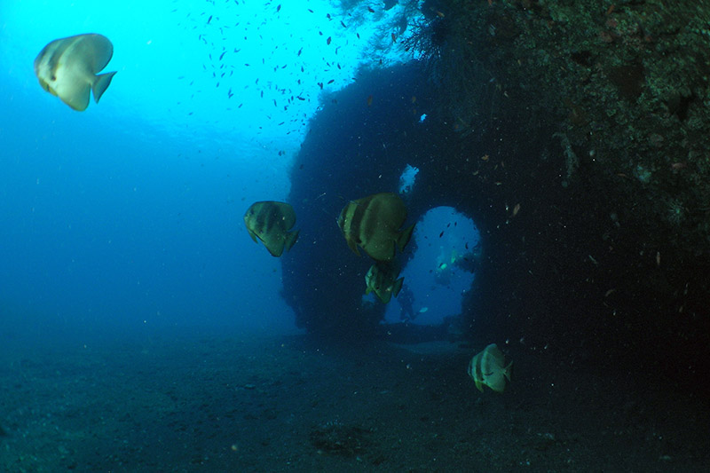
To the north east of Amed lies Tulamben whose claim to fame is the wreck of the USS Liberty, torpedoed off Lombok in WWII and towed to its present site for salvage. Unfortunately the 1963 Mt Agung eruption broke and scattered the hulk but it’s a great snorkeling and diving spot just 30m from the beach and is home to literally hundreds of species of fish.
Try to get there early in the high season or you could be sharing the wreck with up to 200 others. Reasonable accommodation and food.
source by www.directorybali.com
Bali, Tritagangga

Between Amlapura and Amed are the run-down spring-fed Royal pools where you can swim, enjoy basic accommodation, relax and hike.
source by www.directorybali.com
Bali Candidasa

North of Padangbai lies Candidasa. It's a quiet resort area with a beautiful outlook but unfortunately the beach has eroded.
Accommodation is varied and reasonable with plenty of restaurants, a couple of which are outstanding. Everything is to the left or right of the main road with most hotels being beach side.
A pleasant place to stay and explore the area, including the exclusive community of Tenganan.
source by www.directorybali.com
Bali, Padangbai

A deep-water cove and the departure point for ferries to Lombok and points East, Padangbai is home to some mainly cheap accommodation and restaurants that are located just off the sandy beach.
The area also boasts some good dive spots that can be reached by boat.
source by www.directorybali.com
Bali, Jimbaran

On the east side of the airport is the delightful crescent-shaped Jimbaran Bay. Home to some really first class hotels, Jimbaran is known as the seafood capital of Indonesia with literally hundreds of seafood restaurants located right on the beach. As there are more restaurants than diners you should inspect the fish for freshness and the prices before ordering. The dishes are cooked over coconut husks and are both tasty and reasonable if you stay away from lobster. A wonderful place to watch the sunset and the procession of planes bringing a new influx of pink-faced visitors or returning tanned ones to their home countries.
At the airport end are hundreds of fishing boats and an interesting fish market and it is all only 25 minutes from the bright lights of Kuta
source by www.directorybali.com
Bali, Tanah Lot

Site of Bali’s most photographed temple. Best viewed at high tide or sunset, the temple is reached after passing scores of the inevitable shops.
Tanah Lot also features new upmarket accommodation and a beautiful seaside golf course.
source by www.directorybali.com
Bali, canggu

An undulating rural area between Kuta and Tanah Lot with housing, villas and boutique hotels. The beach has some great surf breaks but is dangerous for swimming.
Canggu is around 20 minutes from Legian/Seminyak and it really helps to have your own transport.
source by www.directorybali.com
Bali, Amed

Time to turn your watches back and enjoy the Bali that was. An hour from Candidasa is Bali’s best-kept secret - the enchanting bays that make up the Amed area. Held back until recently by bad roads and lack of power and communications, this is Bali’s newest developing area with accommodation increasing six-fold in the last few years.
Every bay is different, some shingle, some rocky and some sandy, with Bali’s best diving right off the beach. In one bay there’s a Japanese WWII patrol boat just 10m off the shore. Accommodation is reasonably priced and ranges from basic to good quality, with new places opening every couple of months. Food is adequate and cheap but don’t expect nightlife, as there isn’t any. Every bay is lined with double-outrigger fishing boats and the horizon is filled with literally hundreds of triangular sails as they head off to the fishing grounds morning and afternoon. Amed is a perfect destination for families and the more mature travelers. Younger people like it too but often overdose on peace and tranquility after a few days.
source by www.directorybali.com
Bali ,Tuban

Protected by Kuta reef, this narrow strip offers upmarket beachfront hotels with some excellent restaurants, and is close to Kuta Square for a spot of retail therapy.
This area is currently undergoing a makeover and a program to replace the eroded beach is due to begin soon. Kuta, South and Central Legian encompass the one-way system that extends from The Kuta Beach Hotel to The Legian Beach Hotel on Melasti Street. A broad expanse of beachfronts, this busy tourist area is separated from the beach by Jalan Pantai (Beach Rd) and boasts excellent body surfing, boogie boarding and surfing. There are plenty of noisy bars and backpacker accommodation at the Kuta end with the area getting quieter as it gets towards Melasti Street.
source by www.directorybali.com
Bali Seminyak

Seminyak runs from the daytime trendy Blue Ocean Boulevard across Double Six Road to the restaurants and bars of Dhyana Pura Street. Tourist accommodation is scarcer than in the previous areas but you'll find good standard hotels, interesting food and sophisticated nightlife, as well as the mega-noisy Club 66.
Like Legian North, the area attracts a cosmopolitan mix and is home to hundreds of expats involved in commerce of one sort or another.
source by www.directorybali.com
Selasa, 13 November 2007
Bali, Ubud
The town of Ubud in the central foothills is set among rice paddies and ravines and still retains a relaxed pace and rural charm. Apart from its own attractions it is a good base for exploring some of the most historic sites (the “elephant cave” and 12th century reliefs at Gunung Kawi), trekking, bicycle riding and white water rafting. Ubud is also a town of painters.
Accommodation and dining ranges from basic to world class (Princess Diana stayed here). Good food to suit all pockets.
source by www.directorybali.com
Bali, nusadua

Around 10 km south of the airport lies the international tourist enclave of Nusa Dua (meaning "two islands"). This purpose-built area is well planned and the site of beautiful top class hotels, with private beaches geared to the well-heeled and international conferences.
The enclave is safe and manicured, with international restaurants at international prices. Though a tad sterile for many, Nusa Dua has its adherents and is a perfect place for those unhappy with the hustle and bustle associated with other areas.
source by www.directorybali.com
Bali,Sanur
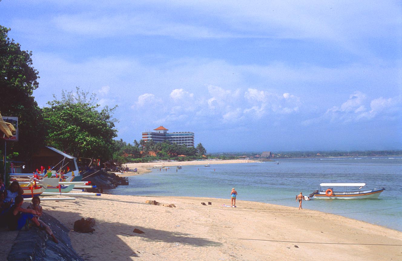
On the southeast Coast around 25 minutes from the airport is the site of Bali’s first luxury hotel, the multi-storied Grand Bali Beach.
Thankfully a later law prohibiting buildings higher than palm tree level has kept the Bali skyline much as it was before the tourist boom. A white sand beach sheltered by the reef, Sanur probably has the safest swimming on the island and is also good for windsurfing and sailing. You'll also find a wide variety of restaurants in the hotels, good outside eating and several interesting pubs.
Sanur has retained its village atmosphere and tends to attract a more mature clientele and families, with most younger people preferring to stay in Kuta. Oddly enough though, Sanur also hosts the island’s red-light district, hidden in alleyways away from the hotel area!
Sanur can be divided into 4 sub-districts:
1) The Grand Bali Beach Area
2) SINAHU - A classy area with good hotels on the beach, a boardwalk, an art market and good eating.
3) BATUJIMBA - Mainly villas belonging to the Indonesian elite and expatriates.
4) SENAWANG - South from the Bali Hyatt. Home to some pricey restaurants and the seedy red-light district.
source by www.directorybali.com
Bali Legian

Legian extends from The Legian Beach Hotel to Hotel Jayakarta on what is still known as Rum Jungle Road. All types of accommodation including villas are available, along with some good eating and a few interesting bars, most of which close by midnight. Legian is a quieter area with less traffic than either Kuta Central or Seminyak as it has its own one-way system leading in and out. The Beach hotels are separated from the actual beach by the new village-owned road, which is closed to traffic.
Because of rocketing property values most expatriates have left this area for cheaper rents but you will still see untouristy things like westerners walking dogs and even one with a dog on his motorbike!
Bali


Bali is renowned for having maintained its traditional culture against the sweeping tides of the Bali calendar event modern world.In many parts of the Island, Life goes on as it has for centuries, with rhythms of ritual, creativity and culture still serving as a community compass, here the arts are woven into everyday, making Bali a World Center of music, dance and visual arts.The Bali Arts Festival is a full month of daily performances, handicraft exhibitions and other related cultural and commercial activities during which literally the whole of Bali comes to the city to present its offerings of dance, music and beauty. On display are trances from remote mountain slopes, forgotten or recently revived village dances, food and offering contests, classical palace dances, stars of Balinese stage, odd musical performances, "kreasi baru" (new creations) from the dance schools of Denpasar, as well as contemporary choreography and dance companies from other islands and from abroad.
source by www.bali-tourism-board
Sabtu, 10 November 2007
Shanghai
Shanghai, located along the coast of the East China Sea and the southern banks of the mouth of the Yangtze River, is a city under the direct jurisdiction of the Central Government. It is the largest metropolis in China and one of the most historically significant cities. It is a flourishing international metropolis, known worldwide for its highly developed industrial, commercial and financial components.
Its has convenient land, air and sea transportation, rich tourist resources, a vast variety of foods and recreational facilities. vIts total area is 2,448 square miles, of which the Pudong New Area occupies 202 square miles. It has a population of over 13 million people.
Shanghai is an ideal "shopping paradise." Nanjing Road, known as "China's No.1 Street", the reconstructed Huaihai Road, Jinling Road, East and North Sichuan Road, the Yuyuan Garden shopping and tourist area, the Ever Bright City Commercial Center, Xujiahui Commercial Center, and Zhangyang Road Commercial Center in Pudong are all packed with rows of shops. Shanghai is also a paradise for gourmets. There are over a thousand restaurants serving the famous 16 styles of Chinese food, such as Beijing, Sichuan, Guangdong, Yangzhou, Fujian. There is also French, Russian, Italian, English, German, Japanese, Indian and many other tantalizing types of foreign cuisine, genuine Muslim food and vegetarian food. In Shanghai you have the world at your fingertips.
source by www.cnto.org
Ningxia

Ningxia Hui Autonomous Region
Ningxia, situated in the northwest of China, is one of the birthplaces of Chinese civilization. The ancient Silk Road passes through this region; a place filled with beautiful mountains and rivers. There are many places of interest such as the Western Xia Tombs, the scenic Liupan Mountain, Shapotou Sand Control Project Tourist Area (which has been chosen as one of "the Five Hundred Best Projects of the Global Ecology" by United Nations), and a variety of other sites. Today, Ningxia has rich varieties of culture including Islamic cultures and relics of the Western Xia culture.
source by www.cnto.org
Silk Road

The Silk Road has more than 2,000 years of history. It began in Chang'an (present Xi'an, Shaanxi Province) in the east and stretched to Rome, Italy in the west. The route crosses Shaanxi, Gansu, Qinghai provinces, Ningxia Hui and Xinjiang Uygur autonomous regions and then passes over the Pamirs, to extend to Central and West Asia and finally reaches the east bank of the Mediterranean Sea and Eastern Europe. The total length of the Silk Road is more than 2,485 miles, over half of the width of China.
The Silk Road was the main artery for business and trade between China and the West. It has played an important role in the exchanges of cultural and trade-goods. As many people already know, China's four major contributions to civilization are papermaking, printing, compass and gunpowder. They were introduced to Western countries via the Silk Road. In return, many aspects of Western civilization that influenced Chinese society made their way back along this road. The Silk Road has been an indispensable instrument in the opening up and developing of cross-cultural friendship. Although modern society is no longer dependent upon this ancient and time consuming method of interaction, the history and spirit of the Silk Road are still a dream sought by tourists either from the East or the West. Along the Chinese section of the Silk Road, there are numerous famous historic and cultural sites. The best known is in Xi'an, where the life-sized Terra-cotta Warriors and Horses were excavated from sites near the tomb of Emperor Qin Shi Huang, known as the eighth wonder of the world. Of the countless other attractions, there are also Dunhuang's Mogao Grottoes, sometimes called an "Oriental Art Treasure".
Loulan was an ancient state in the desert and houses the Ruins of the Ancient City of Gaochang. The road also goes through unique and magnificent natural surroundings, such as Flaming Mountains and Grape Valley in Turpan City, Yadan Landform in Lop Nor, Birds Island in Qinghai Lake and Tianchi Lake on Tianshan Mountain. These places are very attractive to visitors.
In some areas along the Silk Road, there are many ethnic minorities, including Uygur, Hazak and Tajik people. They have great hospitality and unique traditional cultures, life styles, religious beliefs, songs and dances. They add another dimension to the charm of the Silk Road.
When the central government began developing West China, they realized the tourist resources in these regions were endless. The various tourist facilities in the locality are improving day by day, and there have been significant advances in communications. As a result, the Silk Road has become one of the most attractive theme routes for tourists.
source by www.cnto.org
Yinchuan

Yinchuan, also called Phoenix City, is the capital of Ningxia Hui Autonomous Region. An ancient and well-known city in the west, it was once the capital of the Western Xia Dynasty. Today, Yinchuan is listed by the state as one of the 100 famous historical and cultural cities.
There are many historical and cultural sites in Yinchuan. It is the center of the Hui culture. The city also features a variety of unique Islamic architecture. Yinchuan's beautiful deserts, historical sites and local customs are the instrumental in making Yinchuan one of the most attractive places in China.
Mt. Sumeru Grottoes
Located on the eastern foot of Xumi Mountain, the grottoes were constructed over many dynasties, starting during the South and North Dynasties (420-589). There are 20 well-preserved grottoes, winding along 1.2 miles. Amongst these grottoes are a few examples of the important existing grotto art under the state protection.
The Western Xia Tombs
The Western Xia Tombs are located at the eastern foot of the Helan Mountain, 18.6 miles west of Yinchuan. The tombs extend 6.2 miles from north to south and 2.4 miles from east to west. There are nine tombs of kings and over 20 funerary tombs, which were built to fit in with the topography. Before the Ming Dynasty, the kings' tombs were robbed, but many cultural vestiges remain.
source by www.cnto.org
Yangtze River

he Yangtze, China's longest river and the third longest waterway in the world, originates on the Qinghai-Tihet Plateau. Hundreds of rivers and streams join the Yangtze, which flows like a torrent eastward to empty into the East China Sea.
The Three Gorges in the Yangtze River Valley comprise Qutang Gorge, Wu Gorge and Xiling Gorge. The Three Gorges area starts at Baidicheng (White Emperor Town), Fengjie in Sichuan Province and extends to Nanjin Pass, Yichang in Hubei Province. It stretches over a total of 120 miles. Qutang Gorge is renowned for its majestic appearance. The peaks tower above the river and the waters tumble down in torrents. Wu Gorge is splendid, intertwined and secluded, housing the famous Twelve Peaks.
source by www.cnto.org
Huangshan

The city of Huangshan, founded in 1983, is located in southern Anhui Province. t has three districts and four counties. Hefei, the capital of Anhui Province, is 194 kilometers from the city of Huangshan. The Huangshan Airport has opened a dozen flights to Beijing, Shanghai, Hangzhou, Guangzhou, Shenzhen, and Hong Kong. Huangshan also has convenient land transportation. Taking the train, tourists from Shanghai can get off at Wuhu Railway Station, while those from Nanjing and Nanchang can get off at Tunxi Railway Station before taking the bus to Mt. Huangshan.
source by www.cnto.org
Harbin,
Harbin, the capital of Heilongjiang Province, is located in the middle reaches of the Songhua River in the south of the province. The urban area is composed of seven districts: Daoli, Daowai, Nangang, Taiping, Xiangfang, Dongli and Pingfang. The whole city covers an area of 632 square miles, with a population of 2.54 million
source by www.cnto.org
Hangzhou

Hangzhou is the capital of Zhejiang Province. It is located along the banks of the Qiantang River, at the southern end of the Beijing Hangzhou Grand Canal.One of the seven capitals of ancient China, Hangzhou is an ancient cultural city and a well-known tourist city. It is most famous for the beautiful scenery of the West Lake. With an area of 6,047 square miles inhabited by a population of 5.2 million, it embraces six urban districts and seven suburban counties, namely Yuhang, Xiaoshan, Fuyang, Tonglu, Lin'an, Jiande and Chun'an. The Fuchun and Xin'an rivers and Thousand Island Lake are national scenic areas. In the 13th century, Marco Polo praised Hangzhou as the most beautiful city in the world. Hangzhou is also famous for its silk and tea products.
source by www.cnto.org
Guiyang

Guiyang is the capital of Guizhou Province, located at an elevation of 3,000 feet in the very center of the southwest province. It is dominated by mist-shrouded hills that surround the Wujiang Valley.
The climate is mild throughout the year, much like that in Kunming, the capital of neighboring Yunnan Province.The most interesting scenic spot in the city is the Southern Cave, or the "Underground Park" as the locals call it. About half a mile in length, the cave contains spectacular stalactites and stalagmites.
A three-hour journey west from Guiyang will take you to the Huangguoshu waterfall. It is one of the biggest falls in China, reaching 316 feet in height and spanning 346 feet in width. Water pours down the cliff into the Xiniu Pool and as sunlight is diffracted through the drops of water, glorious rainbows are produced. There is a natural cave behind the waterfall, 131 feet above Xiniu Pool. Standing inside and watching the water pouring down is an unforgettable sight. Around Huangguoshu are 18 smaller falls and 30 karst caves.
source by www.cnto.org
Jumat, 09 November 2007
Guilin

Guilin is an ancient city on the shore of the mesmerizing Lijiang River in northeastern Guangxi Zhuang Autonomous Region.The serene mountains, sparkling waters, and exotic rocks typical of karst landmasses in the Lijiang River basin have inspired the saying, "The landscape of Guilin is unmatched under Heaven." Guilin was originally a vast expanse of sea until about one hundred and ninety million years ago, when, owing to the movement of the earth crust, the whole area rose and became land. The limestone bedrock, weathered and eroded by water, became today's fantastic stone forests, peaks, underground streams and caves, thus adding truly unique features to Guilin's already beautiful scenery.
source by www.cnto.org
Guangzhou

Guangzhou, the capital of Guangdong Province, is set along the coast of the South China Sea. Guangzhou covers approximately 2,900 square miles and has a population of 6.6 million people. It is a city famous for its history, as well as its being a port city for foreign trade, and the largest industrial and commercial city in southern China.
Guangzhou has a humid climate, flowers bloom there all year round and it is therefore also know as the "City of Flowers."
There are as many as 150 historical sites in addition to the many modern facilities for recreation in Guangzhou. The city is also famous for embroidery, local opera, and food. Guangzhou also has a convenient transportation system. The Beijing-Guangzhou and the Beijing-Kowloon (Hong Kong) railways, airlines, and water transportation provide easy access to all parts of the country and the world.
source by www.cnto.org
Dunhuang

Dunhuang used to be called Shazhou and is at the western end of the Hexi Corridor. Dunhuang adjoins Anxi to the east, and borders Aksay all the way to the neighboring Xinjiang Uygur Autonomous Region in the northwest. There are many tourist attractions in Dunhuang, which is listed as a state historic and cultural city.
Mogao Grottoes
The Mogao Grottoes, also known as "1000 Buddha Cave", are located 15.5 miles southeast of Dunhuang City. With a total length of 1 mile, the Grottoes wind their way through the broken cliff at the eastern foot of Mingsba Hill. There are five layers of caves built into the mountain. According to historical records, the Mogao Grottoes were constructed in 366 BC. Today there are 492 caves in which murals and sculptures representing different dynasties have been well preserved. The Mogao Grottoes are listed in the World Cultural Heritage and are rated as key relics under state protection.
Ruins of Yumenguan Pass
Yumenguan Pass is located in the Gobi Desert 54 miles northwest of Dunhuang City. It was built during the reign of Emperor Wu of the Han Dynasty. Its name came from the fact that jade from Hotan in Xinjiang entered Central China through this pass. At that time, the pass provided the only access to the north route of the Silk Road.
Yueya (Crescent Moon) Spring
Yueya Spring is near the northern foot of Mingsha Hill in the southern suburbs of Dunhuang City. It is shaped like a crescent moon, and its clear water is surrounded by grass. The Dragon Boat Festival is usually celebrated the 5th day of the fifth lunar month and people usually climb up onto Mingsha Hill to view Yueya Spring. This has become a local custom.
Ruins of Yangguan Pass
The Yangguan Pass was constructed in the period of Emperor Wudi of the Han Dynasty on the Gudong River Bed, 43.5 miles west of Dunhuang. It's named Yangguan because it borders the southern part of Yumenguan Pass. As a center of communication to areas beyond China's interior, it was the only strategic pass on the south route of the Silk Road.
Mingsha Hill
Mingsha Hill, also called Shensha Hill, is 3.7 miles south of Dunhuang City. The hill is as high and steep as a cliff. People can hear a roaring sound of the moving sand as the sand is blown down from the top of the hill.
back to top
Tianshui
In east Gansu, known as the "Small South of the Yangtze River," Tianshui is one of the major cities that offer itineraries for travel eastward. Its weather is pleasant with four distinct seasons. The city used to be a hub of the Silk Road, and is recognized as a national historical and cultural center. There are many interesting places, including some holy sites of the Silk Road, and scenic spots, such as Maljishan Grottoes, Fuxi Temple and Yuquan Taoist Temple.
Maijishan Grottoes
They are situated 18.6 miles southeast of Tianshui. Due to the conical shape, like a stack of wheat, they were given the name Maijishan Grottoes. During the year 713-741, the central part of the cliff collapsed in an earthquake. As a result, it was divided into two parts. Within the 194 caves of the two parts, 7,200 clay sculptures and stone carvings have been preserved, along with more than one third of an acre of frescos.
Maijishan Mountain is a strange peak in the western Qinling Mountains. In autumn it is subjected to continual, fine rain, which creates the wonderful sight of "Maijishan Mountain shrouded by misty rain." It is rated as the best of the eight beautiful scenes in Tianshui.
Wuwei
Wuwei, which was called Liangzhou in the past, is located at the eastern edge of the Hexi Corridor and borders Qilian Mountain to the southwest and Tenggeli Desert in the north. It is an important stop on the way west from Lanzhou. Ancient Liangzhou was a large city; Monk Xuanzang preached Buddhist doctrines here. Wuwei has many places of interest, such as the Eastern Han Tomb in Leitai Temple, Haizang Temple and Tiantishan Grottoes.
The Eastern Han Tomb in Leitai Temple
The Eastern Han Tomb was also named "The Tomb of General Zhang" after a general of the late Eastern Han Dynasty (25-220). He was buried in Leitai Temple after his death. A rare piece of art, a model of the "galloping horse stepping on a sparrow," was unearthed from this tomb.
The Tomb of Princess Hong Hua
The Tomb of the Princess of the Tang Dynasty is 9.3 miles south of Wuwei City. It contains well-preserved colored wooden figurines, camels and horses, as well as silk fabrics. They serve as samples for research in regards to the history of Silk Road.
Zhangye
Zhangye, in the central part of the Hexi Corridor, was known as Ganzhou in the past and is regarded as a granary in this area. Visitors can visit the sleeping Buddha in the Giant Buddha Temple. Visitors can get the feel of the prairie in south Gansu, riding horses and tame deer on the grasslands with the hospitable Yugur people. There are also opportunities to sing and dance with the Yugur people. Mati Temple is near Zhangye in the Sunan area.
source by www.cnto.org
Datong

Datong, the second largest city in Shanxi Province, is located at the northern border near Inner Mongolia. It is an ancient cultural city dating back 2,000 years and known both in China and abroad for its many places of interest, such as the Yungang Grottoes and the Overhanging Monastery on Mt. Hengshan, one of the five holy mountains of Taoism.
Datong is a very interesting city resplendent with architectural treasures, spectacular carvings, exquisite embroidery, intriguing paper cuttings, and oodles of old furniture and pottery. You can get to Datong and surrounding scenic spots from Beijing, Taiyuan, Qinhuangdao and other cities by convenient highways or trains.
source by www.cnto.org
Dalian

Dalian, located at the southern tip of the Liaodong Peninsula, is an important port and industrial and tourist city. Dalian has a long coastline. Dalian covers an area of 4,826 square miles with a population of 5,370,000. It has a pleasant climate with clearly demarcated seasons. Cool summers and warm winters make the city an ideal holiday resort. Dalian abounds with natural resources. It is an important base of fruit and water production in China. Dalian is also known as the "home of track and fields" and the famous "soccer city." The port has many factories, which produce handicrafts such as glassware and shell mosaics. The flourishing coastal city of Dalian is the major port for this northeastern province and is a magnet for foreign investors. Every year, Dalian attracts many regular international events and activities such as the Chinese Scholar Tree, International Fashion Festival, Export Commodity Fair, and International Marathon Competition.
source by www.cnto.org
Kamis, 08 November 2007
Dali

The Dali Scenic Region lies in Dali Bai Autonomous Prefecture located in the northwest of Yunnan Province. Yunnan is made up of one municipality and eleven counties. Dali covers a total area of 11,380 square miles with a total population of 3,063,000, of which minority nationalities make up 1,553,000. The Bai people make up 33.2 percent of the total population and the Yi, Hui, Naxi, Miao and
ther minority nationalities account for a total of 16 percent.
Dali is the major region where the Bais live in compact communities. The capital of the Prefecture, Dali Municipality, is 247 miles away from Kunming. It is located at the center of Dali Bai Autonomous Prefecture, surrounded by beautiful mountains and crystal-clear lakes. Within and around the city, there are many relics and places of historical interest. It was the political, economical and cultural center for 500 years during the Tang and Song Dynasties. The annual average temperature is 59 degree Fahrenheit. The climate is pleasantly spring-like all the year round. The beautiful scenery, varied traditions and the culture of minority nationalities make Dali a well-known place of interest.
source by www.cnto.org
Chongqing

Chongqing is located in the southeastern section of the Sichuan Basin where the Yangtze and Jialing rivers meet. It is the largest industrial and commercial city in southwestern China and the economic center of the upper reaches of the
Yangtze River. It is a metropolis under the direct jurisdiction of the Central Government. Chongqing, also known as Yu, was established some 3,000 years ago. Renowned for its romantic mountains, rivers, and fog, Chongqing is an ideal spot for relaxation. The majority of the buildings in Chongqing are located on the hillsides and mountains surrounding the city. The climate in Chongqing is often cloudy and misty with an average annual precipitation of about l, 000 millimeters. As a consequence, it is also called the "City of Fog."
Chongqing has many places of interest in both its urban and rural regions. Traveling eastward along the Yangtze River, one can enjoy the magnificent Three Gorges. Every year from May through June, the Three Gorges International Travel Festival is held in Chongqing.
source by www.cnto.org
Chengdu

Chengdu, located in the western Sichuan Plain, is the capital of Sichuan Province. It covers an area of approximately 3 million acres, and it comprises 5 districts, 12 counties with a total population of 9.6 million. It is a well-known city with a longstanding history and civilization. Among other interesting facts about the city, Chengdu is also known as the City of Brocade and the City of Hibiscus. Chengdu, as early as 500,000 years, was a major transportation hub for telecommunications in southwestern China.
Chengdu has many places of interest and is famous for its traditional arts and crafts, ethnic folklore, and beautiful landscapes.
Chengdu sports an advantageous geographical location, as well as the Shuangliu International Airport, one of the six largest airports in China. The Chengdu Railway Station is also the largest transportation center in southwestern China and is the meeting point of the Baoji-Chengdu, Chengdu-Chongqing, and Chengdu-Kunming railway lines.
It has easy access to the Three Gorges on the Yangtze River; to Tibet, Jiuzhaigou, and Huanglong Temple, to the Terra-cotta Warriors of Xi'an, and to Mt. Emei and the Giant Buddha of Leshan.
source by www.cnto.org
chengde

The city of Chengde is approximately 143 miles from Beijing. In addition to being one of the first ancient cities to be recorded by the government, it is also one of the ten esteemed national-class scenic spots. There are many places of interest in and around Chengde, such as the magnificent Mountain Resort and the Eight Outer Monasteries. Chengde has convenient transportation, and easily accessible by either train or long-distance bus. Tourist trains and regular buses shuttle between Chengde and Beijing on a daily basis.Also named the Temporary Imperial Dwelling Palace in Rehe, the Mountain Resort was built during the reigns of Emperors Kang Xi and Qian Long of the Qing Dynasty in 1703. The Qing Dynasty was the last feudal Chinese dynasty in existence and this palace served as the second political center of the Qing imperial court. The entire construction took place over a period of 90 years. It covers an area of approximately 1400 acres, double the size of the Summer Palace and eight times that of Beihai Park in Beijing. The estate has a total of 120 ancient buildings, including many pavilions, towers, and temples. Geographically, the Mountain Resort can be divided into two parts: the palace and the gardens. In the southern part of the Mountain Resort are the palace buildings where the Qing emperors lived. The emperors of the early Qing Dynasty often spent their summers at the Mountain Resort, conducting state affairs and engaging in political activities. In 1994, UNESCO listed the Mountain Resort and its surrounding temples as a World Cultural Heritage Site
source by www.cnto.org
Beijing

As the capital of the People's Republic of China, Beijing is the nation's center of government, economy, culture, and international activities, as well as serving as a transportation hub to the entire country. With a population of 11 million people, Beijing contains 18 districts and counties covering an area of 10,450 square miles. The suburbs contain: Dongcheng, Xicheng, Xuanwu, Chongwen, Chaoyang, Haidian, Fengtai, and Shijingshan. An outer suburban area consists of: Fangshan, Mengtougou, Changping, Tongxian, Shunyi, Daxing, Huairou, Miyun, Pinggu, and Yianqing.
Beijing City is an independently administered municipal district located in the northeastern part of China at an elevation of 143 feet above sea level. Beijing has a continental climate. January is the coldest month with an average temperature of 24 degrees Fahrenheit. At an average temperature of 79 degrees Fahrenheit, July is the warmest. The best time to visit Beijing is May, September and October.Beijing has a long history. As early as 500,000 years ago, ancient "Peking Man" lived at Zhoukoudian 30 miles southwest of Beijing. King Wu was the first to declare Beijing the capital city in 1057 B.C. Established in 1045 B.C., Beijing is an ancient cultural city, serving for 800 years as the capital of the Liao, Jin, Yuan, Ming, and Qing dynasties.
Beijing was also known as Peking by the Western world before 1949. In the early nineteen twenties, Beijing became the cradle of China's new democratic revolution. The May Fourth Movement against imperialism and feudalism began in 1919. On October 1st, 1949, Chairman Mao announced to the world the founding of the People's Republic of China.
Beijing is also known as a tourist city for its many places of interest, including ancient architecture, royal gardens, mansions, towers, temples, palaces, and modern structures. It is a gathering place of artists and other talented people.
Airlines connect Beijing to more than 110 cities at home and abroad while the city boasts a fine railroad and highway system for local travelers. Urban construction has brought new changes to Beijing, building a unique combination of ancient civilization and modern metropolis.
source by www.cnto.org
Minggu, 04 November 2007
South America Holidays - Brazil Holidays
The largest country in Latin America and in fact the fifth largest in the world, Brazil was named by the Portuguese settlers after pau-brasil (Brazil wood), which was a hugely important commodity due to the red dye that was extracted from it.
Today, Brazilian culture and spirit is forged from its unique blend of European, African and indigenous people. This has resulted in a truly Brazilian ethos on life and an excellent fusion of food and drink from around the world. Brazil has many areas well worthy of exploration and an ideal starting place must be the marvellous city of Rio de Janeiro, overlooked by Christ the Redeemer since 1931. Brazil also shares the glory of Iguaçu Falls with Argentina. The power and beauty of these waterfalls are immense to say the least and are an unforgettable experience. The Amazon river curls through northern Brazil on its way to the Atlantic and a stay in the Amazon rainforest region can be extremely rewarding with its array of unique animal and plant life.
Join in at Titan Travellers Forum
source by www.titanhitours.co.uk
Chile
A testament to nature's beauty and power; a country of startling contrasts from the salt deserts of the north to the south's spectacular glaciers and lakes. Sandwiched between the Pacific Ocean to the west and the mighty Andes to the east, this uniquely shaped country never exceeds 150 miles in width and its dramatic forests, deep ravines and snow-capped volcanoes support a wealth of flora, fauna and wildlife.
Its capital Santiago is a bustling, vibrant metropolis and is a fascinating city to explore with its wonderful museums and intriguing architecture. It is also an ideal place to sample the hearty Chilean cuisine and of course, their excellent wines. Further south is the city of Puerto Montt with its middle-European architecture and is also the gateway to the stunning Lakes District. Punta Arenas is the country's southernmost city and is located in one of Chile's most famous parts, Chilean Patagonia. This region, which leads to lands end at Cape Horn, is a dazzling explosion of icebergs, fjords, islands and mountains and is truly breathtaking.
source by www.titanhitours.co.uk
Argentina
Flanked by the Andes mountain range to the west and the Atlantic ocean to the east, Argentina contains great lands that are home to the famous Gaucho and is, of course, birthplace of the Tango.
Inimitable Buenos Aires is a true melting pot of the European and indigenous people, creating the "Paris of South America", where wide avenues lead you to magnificent buildings. When it comes to sheer natural spectacle, Argentina has a great reputation.
In the north the spectacular sights and sounds at Iguazu Falls close to the border with Brazil are a not to be missed attraction and further south the Valdes Penninsula offers great opportunities for wildlife spotting. For unspoilt beauty, the Immense Perito Moreno Glacier is a sight to behold and the southern tip of the country provides crystalline lakes, forests and awesome glacier
source by www.titanhitours.co.uk
Antartica
Until 30 years ago only the most adventurous of explorers set foot on this vast continent of snow, ice and unquestionable beauty. Once the ultimate survival challenge as the highest, coldest and windiest continent in the world, today Antarctica is an intellectual challenge to the scientists who inhabit it and presents a wilderness like no other to the modern visitor.Awe-inspiring landscapes, dazzling starlit skies and clean crisp air are certainly part of Antarctica's attraction but the wildlife will also captivate you; chinstrap and gentoo penguins gather on rocky beaches, whilst leopard and elephant seals and humpback, minke and killer whales can be seen amongst the immense ice-bergs. Whilst the perception is often of an uncomfortably cold environment, travelling in the summer months of December to February to the Antarctic Peninsula means temperatures similar to those of a UK winter. A visit to Antarctica presents much more than just a holiday; it is a journey of discovery, enlightenment and life-long memories.
source by www.titanhitours.co.uk
Latin America

Latin America is as diverse as it is vast, stretching from the arid deserts of Northern Mexico to the unspoilt southern Patagonia region of Chile
Titan's ever-growing portfolio of holidays to Latin America gives you the opportunity to see the New World for yourself with its myriad of natural, cultural, historical, and architectural attractions. From the condor of the mighty Andes mountain range and the piranha of the sinuous Amazon River to the unique wildlife contained on the Archipelago of the Galapagos and the glorious glaciers of the Beagle Channel, Latin America never fails to impress.
Latin America epitomises a true melting pot of cultures. The indigenous people, many descended from powerful ancient empires grasp both the old and the new ways of life and intermingled with this, the European settler and the legacy of the Spanish and Portuguese conquests; the result is a truly cosmopolitan society.
No empire, except the ancient Egyptians, has left us such treasures as the Incas and their mountaintop ruins at Machu Picchu and the Mayans with vast temples at Chichen Itza and Palenque. It is hard to believe the massive scale of these empires and how they could collapse and be forgotten, only to be re-discovered and explored in the last hundred years. Now ripe for exploration - let us be your host on a journey of discovery to beautiful Latin America.
source by www.titanhitours.co.uk
source by www.titanhitours.co.uk
Africa

The intoxicating countries of Africa, Kenya, Tanzania, Namibia, Zambia and Botswana conjure up an image of colonial grandeur, unparalleled adventure, elegant style and for most, the anticipation of an exhilarating experience. All with their own distinct characteristics, they share in common the vast expanse of African skies, far reaching horizons and outstanding wildlife. The hustle and bustle of city life gives way to the bushveld-savannah where the Lion is King and to the sophistication of the winelands and the crystal clear waters of the Indian Ocean that make Africa an all-encompassing revelation. This is a continent full of adventure, offering the discerning traveller the chance to discover a world beyond their wildest dreams.
White buildings topped by golden minarets shimmering in the heat, and the terracotta and ochre hues of expansive deserts, all the more vivid beneath constant blue skies, is the image we associate with North Africa.
Take a magic carpet ride to Morocco and experience the classic picture postcard images of Imperial Cities, endless palmeries, golden sand dunes as well as the blend of bustling souks and markets that surround Djema El Fna square in the Red City of Marrakech and the tropical Todgha Gorge (Todra Gorge), nestling in the snow-capped Atlas mountains.
Egypt needs no introduction, more than living up to expectations and, for many of our clients, experiencing it is a lifetime's dream come true. Entering dynamic Cairo is the beginning of a journey into an ancient world of familiar stories peopled by kings and commoners from a hedonistic, yet sometimes cruel, age, now woven into bustling modern day life. In stark contrast to the mysterious and awesome Pyramids and Sphinx, the cruise ships glide leisurely along the banks of the majestic Nile, passing cameos of simple riverside life, still unchanged by modern influences.
source by www.titanhitours.co.uk
New zeland

New Zealand has its so-English greenness, breathtaking mountains and lakes, forests dominated by vividly plumaged birds, waterfalls and geysers.
Even if you have seen the Lord of the Rings trilogy you will only have touched the surface of Aotearoa – Land of the Long White Cloud, so named because as you approach New Zealand by sea the first sighting of the country is the dramatic snow-capped Southern Alps, which appear like a ‘long white cloud'. When travelling from one island to the other you may be forgiven for feeling that you have experienced two different parts of the world, as the diverse sequence of landscape is like no other country in the world. New Zealand lies on the southern rim of the Pacific Ocean, where a rich tapestry of Maori, Polynesian and European influences has created a wonderful blend of cultures.
North Island
Northland and the Bay of Islands
This is where it all began, the birthplace of the Nation and cradle of the country, which is steeped in historical association. This is a region over-endowed with pristine beaches, rugged headlands, dense Kauri forests and enchanting deserted islands, dotted through the sheltered turquoise waters.
Big Cities
Auckland, the country's largest city, has an enviable harbour setting over which spans the stunning harbour bridge linking the cosmopolitan downtown area to the north shore. This is the 'City of Sails', where the three 'b's', boats, beaches and barbecues, conjure up an enviable aquatic lifestyle and where time can be spent watching the crystal clear waters as the yachts display their colourful spinnakers. Wellington lies at the southern most tip of the north island where the blue bowl of its natural harbour and the bush-clad hillside makes this a perfect setting for the nation's sophisticated capital. Soaring glass skyscrapers glisten in the first light of morning before the hustle and bustle of the day begins. This is the political and financial heart of the country and gateway to the south island.
The Natural Elements
Magical lakes teeming with brown and rainbow trout can be found in Rotorua and Taupo, the latter covering an area of 230 square miles and thought to have been created by one of the largest volcanic eruptions on earth. The sacred peaks of Ngauruhoe, Tongariro and Ruapehu combine to create the Tongariro National Park, formed only 15 years after Yellowstone in the USA, the first National Park in the world. Soaring geysers, bubbling mud pools, tinted silica terraces and mineral spas can all be found in this geo-thermal wonderland of the north island.
South Island
A Flavour of the Cities
Christchurch is a very English garden city full of charm, bedecked with blossoming flowers whilst the gently flowing Avon River gives rise to a quiet and relaxing way of life. The undulating Port Hills give magnificent views over the city and Southern Alps where extensive walking tracks can be found and beyond these on the Banks Peninsula, a real gem can be found in Akaroa, which still has a distinct style of a former French settlement.
Dunedin has an elegant and convivial atmosphere. This compact city with its fine Victorian and Edwardian architecture and striking stone structured railway station is favourably enhanced by its proud historical traditions and strong Scottish influence.
National Parks and Coastal Features
The overwhelming beauty of the west coast, a UNESCO World Heritage area, with its rugged alpine peaks mantled by thick blankets of snow, a colossus of tumbling glaciers and dramatic coastline leads to the Southern Alps and some of the most impressive and rewarding scenery the country has to offer. Absorb the splendour of the lakeside towns of Wanaka and Te Anau before seeing the natural paradise of the Fiordland National Park with its tangled labyrinth of rainforest, still largely unexplored. Stunning isolated beaches, fascinating wildlife and interesting geological features all make this an island of ineffable charm
source by www.titanhitours.co.uk
Australia Holidays - Northern Territory Australia Holidays
The Northern Territory is commonly referred to as Australia's Outback and encompasses the ‘Top End' and the ‘Red Centre'. Here you can experience the ‘real' Outback, breathtaking National Parks, images of early Australia, the culture of the indigenous people, together with vibrant and modern towns.
source by www.titanhitours.co.uk
australia
So you think of heading Down Under for a holiday? Once visited, these paradises are never likely to fade from the memory. Australia has its desert, the famous ‘Red Centre’, a refuge of awesome tranquillity, its rainforests in the north, the Great Barrier Reef off semi-tropical Queensland and, in the south, vast sandy bays and the cliff-dominated shoreline of the Great Ocean Road. New Zealand has its so-English greenness, breathtaking mountains and lakes, forests dominated by vividly plumaged birds, waterfalls and geysers.
www.titanhitours.co.uk
